GIS applications

Here you will find an overview of the nationwide or project-specific geoinformation data of the Ministry’s GIS applications.
What is a Geographic Information System?
A Geographic Information System, also called a GIS, is a "computer-based information system" that consists of hardware, software, data, and applications. A GIS extends the capabilities of a traditional map. It links digital geometric data such as maps, plans, and images with attribute data such as tables or databases within a single system and visually represents relationships.
With a GIS, spatial data can be digitally captured and edited, stored and reorganized, modeled and analyzed, and presented both alphanumerically and graphically. Furthermore, it combines a database with the methods useful for processing and visualizing these data.
Geoinformation Data of the Department
The department collects extensive geoinformation data from the following areas of responsibility:
-
Agriculture
-
Forestry
-
Water Management
The geoinformation data are collected nationwide or project-specifically for regions or municipalities from long-term measurement series and statistical surveys and are published in the form of written publications, printed maps, and digital map collections. The Ministry cooperates with the Agricultural, Forestry, and Water Management Computing Center as a technical and logistical partner.
Please note the copyright and intellectual property notices on the Ministry’s website.
The Department’s Most Important GIS Applications
-
eBOD – Digital Soil Map
-
eHYD – Hydrographic Service
-
HORA – Flood Risk Zoning Austria
-
WISA – Water Information System Austria
-
AgrarGIS

eBOD – Digital Soil Map
The web GIS application eBOD represents the online version of the digital soil map and allows users to access all site characteristics of agriculturally usable and mapped soils in Austria free of charge. No additional installation or registration is required. The only requirements are the use of the current version of a web browser and acceptance of the copyright terms.
This comprehensive service is a cooperation between the Federal Forest Office, the Ministry, and the Agricultural, Forestry, and Water Management Computing Center. In addition to detailed mapping and analysis results, it offers graphical representations of individual soil types in the form of profile drawings to illustrate the characteristic features and variability of soil horizons. Various thematic evaluations complement the application possibilities of eBOD and provide opportunities for future expansions.
High-resolution color orthophotos (covering the entire territory of Austria!) as well as the topographic maps of the Federal Office of Metrology and Surveying (ÖK50, ÖK200, ÖK500) can be displayed as base maps for orientation and toggled on or off.
In addition to vector-based thematic representations starting at a scale of 1:30,000, raster overview maps of all thematic evaluations are now available for small-scale representations.
A powerful, browser-based GIS client is available to users. Extensive address search functions and the option to enter coordinates ensure quick access to the desired objects. Diverse display options with toggleable base maps, as well as the optional use of labeling and legend tools, allow for customized map visualization.
Continue to eBOD – Digital Soil Map (in German only)

eHYD – Hydrographic Service
The Hydrographic Service in Austria operates a basic network to monitor the essential components of the water cycle.
The map provides an overview of the measurement stations for precipitation, runoff, and groundwater, including springs, and offers data from the start of observations up to the current Hydrographic Yearbook for download.
Continue to eHYD – Hydrographic Service (in German only)

HORA – Flood Risk Zoning Austria
The Flood Risk Zoning Austria (HORA) project is offered as a digital hazard map on the Internet. On the HORA website, it is possible to search by address, access the digital hazard map, and use various zoom settings to see how flood- or earthquake-prone a house or property is.
HORA, a cooperation between the Federal Ministry and the Austrian Insurance Association (VVO), is a nationwide risk zoning system for natural disasters, currently focusing on floods and earthquakes. This unique European project, created through collaboration between the public and private sectors, was implemented along more than 25,000 river kilometers over four years.
In early 2006, the European Commission presented a directive proposal for assessing and managing flood risks. It includes, among other things, flood risk maps, proactive methods for evaluating flood risks, public information and involvement, as well as implementation, reporting, and scheduling requirements. With Flood Risk Zoning Austria, Austria already meets the requirements of the European Union and positions itself as a European pioneer in flood risk assessment.
Continue to HORA – Flood Risk Zoning Austria (in German only)
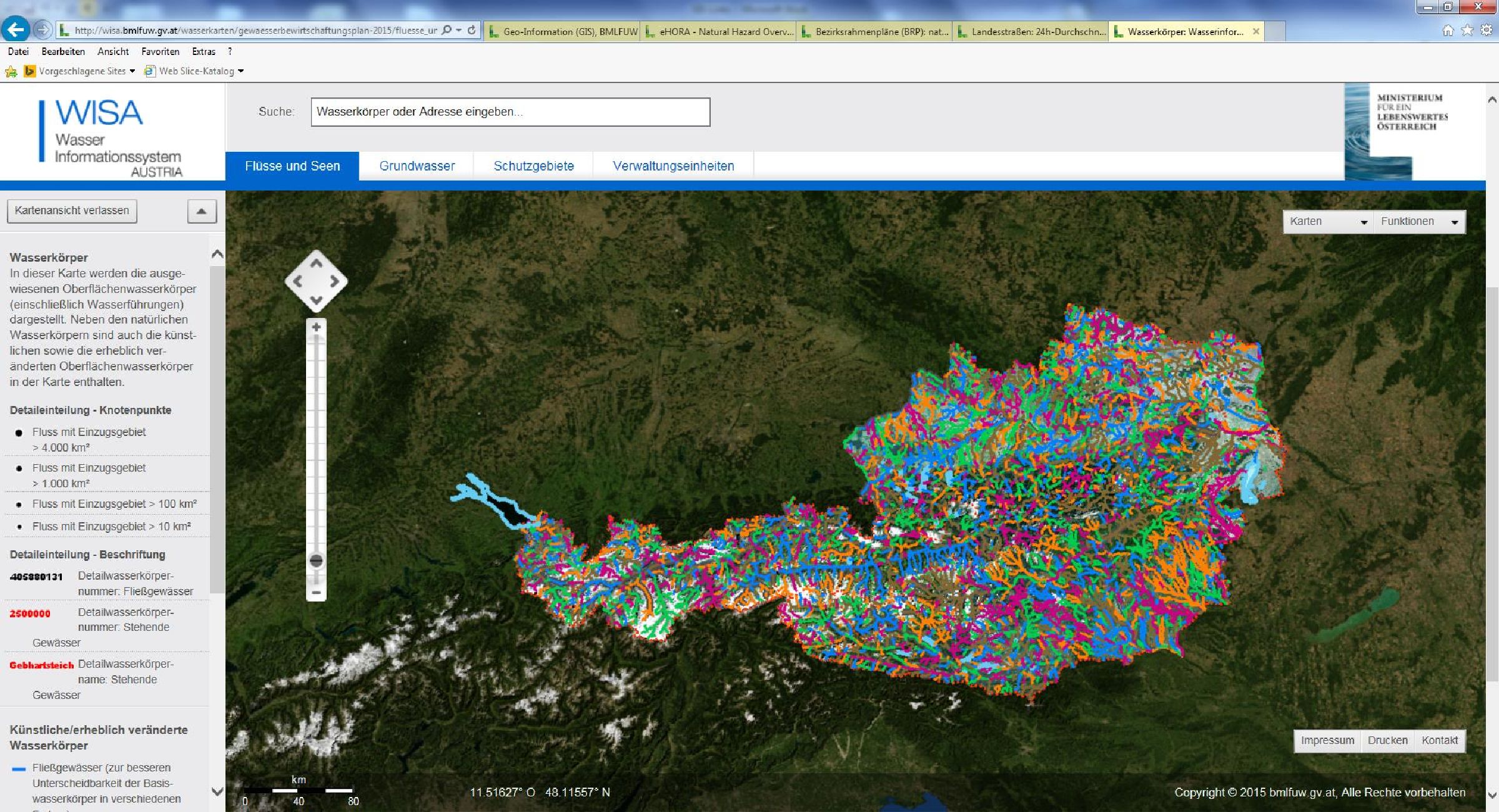
WISA – Water Information System
Through the WISA WebGIS, flood hazard and risk maps as well as the maps of the National Water Management Plan (NGP) can be accessed. The flood hazard and risk maps show areas with potentially significant flood risk, floodplains for floods of high, medium, and low probability, and associated process intensities such as water depth and flow velocity. The risk maps visualize the impacts on different protected assets. The draft maps of the NGP 2021, NGP 2015, and NGP 2009 display the respective contents for rivers, lakes, and groundwater, as well as protected and conservation areas, and provide further information.
Continue to WISA – Water Information System Austria
AgrarGIS
The web GIS application AgrarGIS was discontinued at the end of February 2015. At the end of 2015, the page for downloading the areas digitized in AgrarGIS was also taken offline.
Registered users have the option, after logging in with their farm number, to use the applications “Praxisplan Waldwirtschaft” and “Geokontakt” via the following link. (in German only)
Additionally, users can access the free program QGIS.
Users who primarily want to use QGIS for forestry applications are recommended to install QGIS Forst. It offers several user-friendly special settings. Users with limited GIS knowledge are also advised to use this version of QGIS.
Continue to QGIS Forst (in German only)

WALDATLAS – The Geodata Platform for Forests
The Waldatlas is the first interactive map collection providing nationwide, quality-assured, and free spatial representations on the topics of forests, natural hazards, and biodiversity. The application is available as a display and search service and offers all interested users the necessary data to explore forests digitally.
The application complements existing GIS systems and platforms of the federal states and other stakeholders at a supra-regional level.
Go to Waldatlas (in German only)
The digital added value lies not only in general spatial information but also in operational use as a planning basis for practical applications. Numerous datasets have been implemented from Open Data interfaces or the European geodata infrastructure (INSPIRE). The associated resources are documented in the metadata.
In the era of the federal digitalization initiative, a spatial information and knowledge tool plays a key role in raising awareness of the diverse ecosystem services of forests in Austria.
Waldatlas Flyer (in German only)